
The swamplands of Louisiana have given rise to a swirling weather system that closely resembles a tropical storm. It is causing a historic deluge to hit the state, with some areas near Baton Rouge already seeing nearly a foot of rain as of noon on Friday, with another foot or more still to come.
Rivers are already rising to record levels, and are likely to keep climbing into uncharted territory. With the National Weather Service warning of "severe to catastrophic" flooding from what it described as an "unusual heavy rainfall event," Governor John Bel Edwards declared a state of emergency and deployed the National Guard.
Amtrak stopped a Chicago-to-New Orleans train in central Mississippi because of flooding on railroad tracks in the southern part of the state.
Water rescues were ongoing throughout the day on Friday across parts of Louisiana and southwest Mississippi, according to media reports, as rivers, creeks and other bodies of water rose rapidly.
The flooding is the result of a sluggish storm system fed by an unusually potent stream of atmospheric moisture pushing north-northeastward off the Gulf of Mexico.
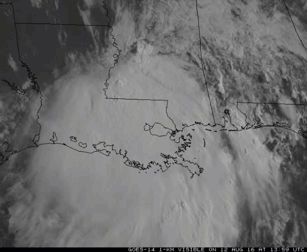
GOES-14 rapid-scan imagery showing the storms over the Gulf Coast on 8/12. See more at goo.gl/AMZVXp

The source region for this moisture is the waters of the Gulf, which are several degrees milder than average for this time of year — as high as 90 degrees Fahrenheit in some areas — which is adding even more moisture to the atmosphere than would typically be available.
In New Orleans, the precipitable water measured in the atmosphere on Friday morning was 2.8 inches. This metric, which measures the amount of water in a column of air, puts that region "in record territory," the National Weather Service said in a technical discussion.
This reading, the agency's forecasters wrote, "is near the all-time max as has been the case the past 48 hours with this
tropical airmass."
tropical airmass."
Such high values there are typically only seen during tropical storms and hurricanes, which transport huge amounts of water from the tropics to more northern latitudes and can cause widespread flooding.


Numerous rivers in southeast Louisiana and southern Mississippi have risen sharply above their banks, and with more rains yet to come, a long duration flood event may be the result.

IMAGE: NWS


The Comite River near Baton Rouge and Amite River near Denham Springs in Louisiana are predicted to set record crests over the weekend, for example. This could put many homes in the Baton Rouge area at risk of flooding.
If rainfall forecasts from computer models — some of which suggest up to 12 to 24 more inches of rain could fall before the weekend is over — hold, then that flooding will just be the beginning of a larger disaster.
Additional reporting by the Associated Press.
 Popular
 Tags
Tags Videos
0 comments:
Post a Comment